By insideSail
Automated technical check · version 2 ·
Earth, ellipsoid and datum
Coordinates need a model and a reference.
In this guide
A globe is a useful first picture of Earth, but a perfect sphere does not describe its entire geometry. Earth is approximately flattened at the poles.
A reference ellipsoid represents that shape through a regular mathematical surface. Mountains, the seabed and variations in the gravity field are not drawn as distortions of that ellipsoid: they belong to different descriptions.
Separating the model from the physical surface helps explain what latitude actually means.
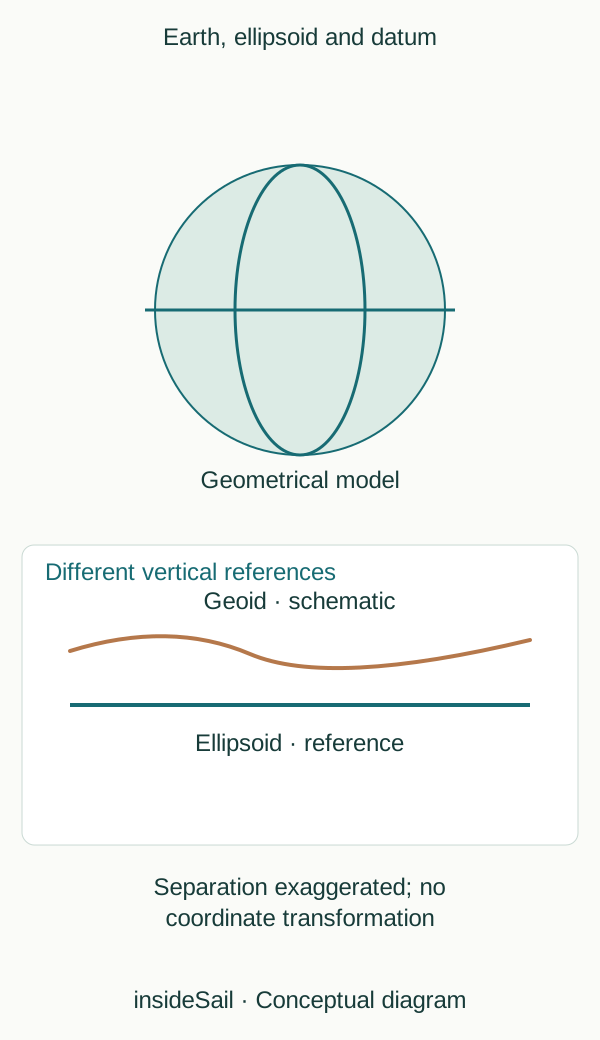
Teaching schematic not to scale; without local data or operational approval.
insideSailOriginal insideSail artwork — all rights reservedEnlarge the diagram
The same expression, different references
A datum ties a coordinate system to Earth. A latitude–longitude pair should therefore not be treated as a completely self-contained identifier.
Charts and systems may declare different references; their relationship requires an appropriate transformation rather than a shift invented by the user. WGS 84 is familiar in GNSS contexts, but seeing that name in a setting does not automatically verify every source reaching the screen.
Latitude and longitude are angles rather than rectangular metre coordinates. Meridians converge towards the poles, so the same longitude interval represents different distances at different latitudes.
On an ideal sphere, latitude is measured from the equator; in ellipsoidal geodesy, geodetic latitude uses the normal to the ellipsoid. That distinction explains why a teaching globe can be useful without serving as a data-transformation tool.
The geoid is another idea: a surface related to Earth’s gravity field, often described in relation to mean sea level. It is not simply the ellipsoid with waves on top.
Vertical references for land elevations and charted depths may differ too. “Horizontal” and “vertical” do not become compatible merely because both use the word datum.
Chart and water-level lessons treat the vertical reference separately.
Coordinate format is a writing choice. For example, 42.5° equals 42°30.0′: the 0.5 fraction is multiplied by 60.
It is not 42°50′. This conversion preserves the angle, whereas a datum transformation changes how values relate to the physical surface.
These operations answer different questions and should not be hidden inside one vague “convert coordinates” instruction. The existing format lesson develops notation while retaining datum identity.
A height may be geometric relative to an ellipsoid or related to a gravity-based reference. Mean sea level is a context-dependent average rather than each instantaneous crest.
Depth datum is another reference again. Drawing three nearby reference lines makes the issue visible: one point can have different numerical heights depending on the chosen zero.
That does not establish point movement; it may simply reflect the reference used.
- An ellipsoid is a mathematical model.
- Datum is part of coordinate identity.
- Format, horizontal reference and vertical reference are different choices.
Concepts in this lesson
Geodetic datum
Reference relating a coordinate system to Earth.
Reference ellipsoid
Regular mathematical surface used as a geometrical Earth model.
Sources and references
- Boat Crew Handbook — Navigation and Piloting, BCH16114.3 ↗
United States Coast Guard · Chapter 3 A.1–A.5, printed pp.3-2–3-7; B.4–B.6 pp.3-13–3-24; E.8 pp.3-88–3-93.
Selected geometrical concepts only. US procedures, numerical equipment claims and protected artwork excluded.
Checked on - Geopotential surfaces and datums ↗
NOAA National Geodetic Survey · Geoid and reference ellipsoid explanatory paragraphs.
No North American datum transformation or source diagram reproduced.
Checked on
Keep discovering
The next piece of the puzzle
Discuss this concept
Loading the conversation…