By insideSail
Automated technical check · version 2 ·
GNSS, AIS, radar and sounder: what reaches the screen
Four information families with different physical origins.
In this guide
GPS is a satellite navigation system; GNSS is the broader family of such systems. A receiver relates signals and timing to estimate position and other quantities.
This differs from receiving another vessel’s identity or observing an echo. “Electronic” groups very different equipment: understanding an indication begins with the phenomenon that produced the data.
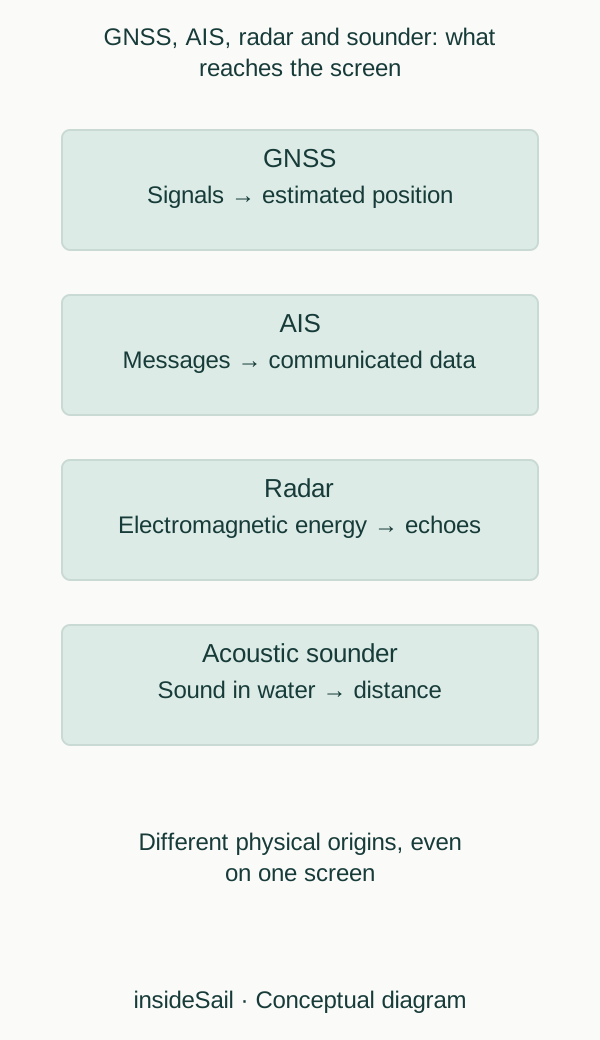
Teaching schematic not to scale; without local data or operational approval.
insideSailOriginal insideSail artwork — all rights reservedEnlarge the diagram
Receiving a message is not measuring a target
AIS communicates station-transmitted information, including identity fields and movement data. Some fields depend on human entry and others on sensors.
An AIS contact is therefore communicated information with origin and time, not an independent measurement of every object at sea. A vessel may be absent from that layer.
No message does not establish no object.
Radar transmits electromagnetic energy and receives echoes. Return timing and direction help represent relationships with reflectors.
The screen shape is not a photograph: reflectivity, geometry, water, precipitation and processing affect presentation. Placing an AIS name over an echo combines two origins.
Their association and combined appearance should not erase the difference between message and measurement.
An acoustic sounder uses sound and returns to estimate distance to a reflector, usually the bottom. Its displayed value also depends on the configured reference: transducer, surface and keel are different references.
A reading is not automatically the chart sounding, which has another datum. Relating them requires water level, position and context alongside knowledge of the installation.
A heading sensor responds to orientation; a GNSS receiver can supply ground movement. Speed through water is another relationship, often supplied by another sensor.
Combining values can produce derived quantities after references and calibration are considered. Sounder physics is different too: sound propagates through water, while radar uses electromagnetic waves.
Medium, frequency and reflector form part of measurement.
A position indication can refer to an antenna or be displayed using a configured vessel relationship. A transmitted contact also has an origin in the other system.
A diagram may reduce different physical points to one hull symbol. Symbol size verifies neither actual dimensions nor every part’s precise location.
This distinguishes data point from physical object without installation or compensation instructions.
- Identify the origin of each field.
- AIS communicates; radar observes returns.
- Measured depth and chart soundings have their own references.
The concept in a few words
GNSS
Family of satellite navigation systems used by receivers to estimate position and other quantities.
Sources and references
- AIS frequently asked questions ↗
United States Coast Guard Navigation Center · Questions 1 and 11: information exchanged and static/dynamic data.
No US carriage rule, update-rate claim, identity guarantee or collision-avoidance instruction imported.
Checked on - Boat Crew Handbook — Navigation and Piloting, BCH16114.3 ↗
United States Coast Guard · Chapter 3 C.1–C.2 pp.3-28–3-29; C.6–C.9 pp.3-35–3-49; G.2 pp.3-130–3-131.
Physical sensor/display relationships only. Historical accuracy, legal carriage and operational claims excluded.
Checked on - GPS accuracy — archived official explainer ↗
GPS.gov · User accuracy; signal-in-space accuracy; obstruction, geometry and receiver effects.
Archive identifies itself as no longer updated since February 2025. Used for enduring error categories, never a current accuracy guarantee.
Checked on
Keep discovering
The next piece of the puzzle
Discuss this concept
Loading the conversation…