By insideSail
Published without technical review · version 2 ·
Course, leg and route on a plot
Route geometry does not establish navigability.
In this guide
A waypoint identifies an intended position on a route. A leg connects successive points, while a route assembles the legs.
The planned course of a leg describes the geographical direction of its line. The heading to steer is another question, because movement through water and the water’s own movement can change the ground track.
A clearly drawn arrow represents a precise intention, but it remains an intention.
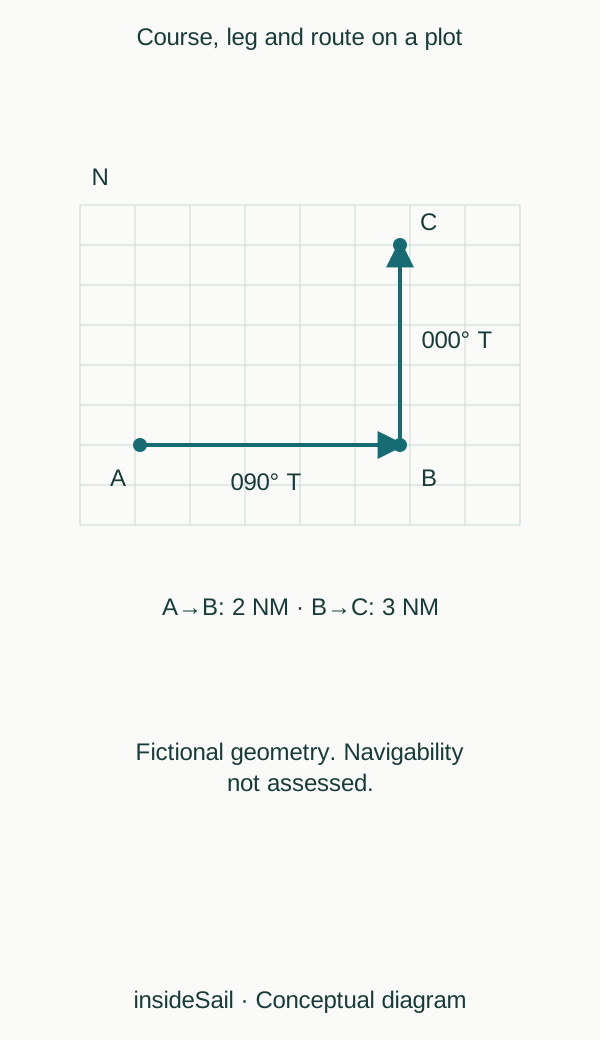
Teaching schematic not to scale; without local data or operational approval.
insideSailOriginal insideSail artwork — all rights reservedEnlarge the diagram
Angle and distance are separate fields
On a local plane with north upwards, line orientation can be expressed as a clockwise angle from north. Its length can be expressed in nautical miles.
Endpoint coordinates, course and distance describe related but different aspects. A plot must retain the angle reference and distance scale.
An inclined paper line does not supply a magnetic course merely because it resembles a compass rose.
The actual track may cross the planned line, diverge from it or approach the waypoint from another direction. Perpendicular distance from the line measures lateral displacement; distance to the waypoint is another quantity.
A boat close to the endpoint can still be well away from the leg. Electronic labels such as cross-track error describe this geometry, while sign and display conventions depend on the system.
A usable route needs information absent from the grid: depths, obstructions, restrictions, tides, conditions, manoeuvring space and alternatives. Adding waypoints can create a more detailed line without resolving these questions.
Geometrical construction and nautical appraisal are different tasks. The drawing contains no steering instructions, acceptable offsets or operational waypoint-entry sequence.
A leg has direction. B→A has the same distance as A→B but reciprocal orientation.
In the example, A→B is 090° T and B→A is 270° T. A waypoint name contains no such direction: connection order establishes it.
This makes a waypoint list legible and avoids treating a reversed route as retaining every original course.
A line represents an ideal route axis without width. Physical use involves dimensions, uncertainty and movement beyond that axis.
Drawing a band distinguishes nominal trajectory from space, but a teaching band’s width should not become a valid margin. A system’s ability to connect points automatically solves a geometrical task; appraising the surrounding space is a separate nautical task.
- A leg has direction and distance.
- Planned route and observed track differ.
- A geometrically valid line can be an unsuitable route.
Sources and references
- Boat Crew Handbook — Navigation and Piloting, BCH16114.3 ↗
United States Coast Guard · Chapter 3 A.1–A.5, printed pp.3-2–3-7; B.4–B.6 pp.3-13–3-24; E.8 pp.3-88–3-93. Chapter 3 D.6–D.8 pp.3-56–3-60; D.12 pp.3-69–3-73.
Selected geometrical concepts only. US procedures, numerical equipment claims and protected artwork excluded. Variation/deviation/course vocabulary only; no compass-adjustment procedure.
Checked on
Keep discovering
The next piece of the puzzle
Discuss this concept
Loading the conversation…