By insideSail
Automated technical check · version 2 ·
Distance and local chart scale
Separate paper length, geographical angle and physical distance.
In this guide
Physical distance is not the length in centimetres appearing on paper. Relating them requires an appropriate scale.
On Mercator, scale varies with latitude, as the projection lesson explains. A small-area schematic may use a local scale for a geometrical example.
On an actual chart, segment and scale references belong to the particular document.
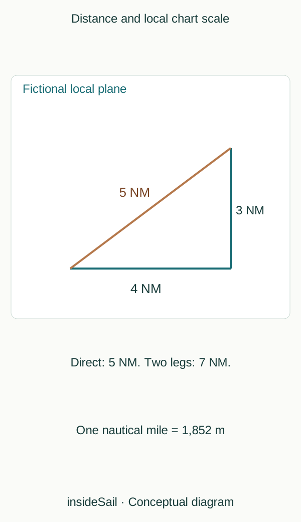
Teaching schematic not to scale; without local data or operational approval.
insideSailOriginal insideSail artwork — all rights reservedEnlarge the diagram
Latitude is not longitude
The international nautical mile is exactly 1,852 m. Associating one nautical mile with one minute of latitude is a useful geographical approximation, not a new exact definition everywhere.
A minute of longitude represents progressively shorter distances at higher latitudes because meridians converge. Confusing the two margins of a grid can produce an error even when the minute interval was read correctly.
On a spherical model near latitude 60°, a minute of longitude represents approximately half the distance of a minute of latitude. The figure illustrates that convergence rather than providing a universal factor for charts of any projection.
Distance should be related to a scale in the relevant latitude region. Transferring a length to a margin far away in latitude can mix different enlargements.
A ruler measures an image dimension; dividers can transfer an interval. Neither tool automatically corrects an inappropriate scale, a distorted print or a wrong reference.
These examples distinguish representation problems without plotting a usable route. In subsequent applications, geometrical distance is only one planning component alongside actual conditions and constraints.
Unit conversion preserves physical quantity. A fictional 3 nautical miles is exactly 5,556 m, or 5.556 km.
Numerical representation changes without changing the segment. This helps compare metre dimensions with nautical-mile chart distances without using habitual but inconsistent factors.
Drawing scale remains another relationship, independent of the unit used to record distance.
On a small Cartesian plane, perpendicular components give direct separation: displacements of 3 and 4 nautical miles yield √(3²+4²)=5. Summed legs total 7 rather than 5.
Neither calculation is wrong: they describe different lines. On a globe or broad chart, geometry requires the appropriate geographical model.
The abstract plane explains the distinction without converting angular coordinates into metres by simple subtraction.
- The nautical mile is exactly 1,852 m.
- Longitude and latitude minutes are not interchangeable distances.
- Direct distance and summed legs can differ.
Sources and references
- Boat Crew Handbook — Navigation and Piloting, BCH16114.3 ↗
United States Coast Guard · Chapter 3 A.1–A.5, printed pp.3-2–3-7; B.4–B.6 pp.3-13–3-24; E.8 pp.3-88–3-93.
Selected geometrical concepts only. US procedures, numerical equipment claims and protected artwork excluded.
Checked on - Nautical cartography ↗
NOAA Office of Coast Survey · Map projections; chart scale; cartographic generalisation.
Projection and scale concepts only; US paper-chart policy is not applied to Europe.
Checked on
Keep discovering
The next piece of the puzzle
Discuss this concept
Loading the conversation…