By insideSail
Automated technical check · version 2 ·
Highs, lows and circulation
Pressure distribution matters more than an isolated number.
In this guide
A high is a region of relatively elevated pressure; a low is a region of relatively reduced pressure. “Relatively” matters: the names describe surroundings rather than a universal boundary making 1013 hPa the division between good and bad weather.
A pressure reading at one point does not show a system’s shape, size or development.
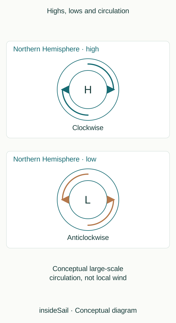
Conceptual schematic not to scale; no local forecast or operational decision.
insideSailOriginal insideSail artwork — all rights reservedEnlarge the diagram
Gradient, rotation and surface
Pressure gradient is pressure change with distance. It relates to a force tending to accelerate air from higher towards lower pressure.
Earth’s rotation modifies movement through the Coriolis effect; near the surface, friction also matters. The result is not simply a straight arrow between centres.
In large-scale Northern Hemisphere circulation, air typically turns clockwise around highs and anticlockwise around lows.
In ideal models away from the surface and equator, balance can produce flow approximately parallel to isobars. Near the surface, air can cross them.
The diagram explicitly identifies Northern Hemisphere conceptual circulation. It does not apply the same rotation to the Southern Hemisphere, where the characteristic direction reverses, or predict wind in a coastal shelter.
Vertical movement, moisture and stability help explain cloud and precipitation. Ascent can favour cooling and condensation; subsidence can limit cloud development.
That does not make every high a clear sky or every low a storm. A high can coexist with fog or low cloud.
Understanding systems means relating processes rather than turning H or L into a voyage verdict.
An isobar is not an air current. It joins pressure values, just as a contour joins elevations.
The comparison explains gradient: the same difference across a smaller distance means a greater spatial change. Actual air motion responds to forces and flow history.
A curve organises the field, while a wind arrow describes motion; one should not be read as the other.
Centres can move and develop. Pressure at one location can rise because a structure approaches, the field changes or both.
Time tendency and spatial gradient are different quantities. Readings three hours apart show temporal change; two locations at one time show spatial change.
Neither difference alone determines wind speed aboard.
- Highs and lows are relative to surroundings.
- Gradient, Coriolis and friction have different roles.
- High pressure does not guarantee clear skies.
Sources and references
- High and low pressure ↗
Met Office · Characteristics of highs/lows; pressure gradient; Northern Hemisphere circulation.
Broad physical distinctions only; no pressure threshold or deterministic weather rule.
Checked on
Keep discovering
The next piece of the puzzle
Discuss this concept
Loading the conversation…